Korea Institute of Energy Research
Korea Institute of Energy Research (KIER)
LiDAR for Continuous Remote Monitoring of Air Pollution
Measure the exact location and concentration of fine particulate matter emitted into the atmosphere, even in target areas that are far away
Technology Overview
A technology that uses LiDAR sensors to continuously monitor air pollution remotely by measuring the precise location and concentration of fine particulate matter emitted into the atmosphere, even in distant target areas
Designed to meet the requirements for LiDAR sensor miniaturization, visual safety, system protection, and high resolution, enabling stable operation in a variety of outdoor environments
Key Technology Features
Core Features for Developing an Optimal Fine Particulate Matter LiDAR
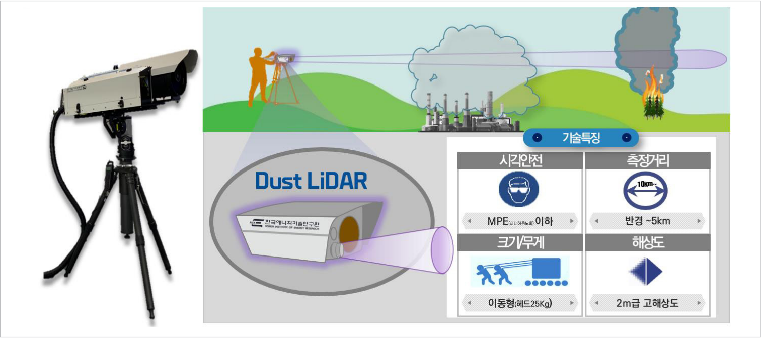
High-resolution, multi-wavelength scanning LiDAR; the measurement unit and control unit are separated for ease of installation and mobility, and the measurement unit head—which houses the optical system—weighs approximately 25 kg
Uses an Nd:YAG laser to simultaneously measure ultraviolet, visible, and infrared wavelengths (355 nm, 532 nm, 1064 nm), and incorporates measures to ensure visual safety
With a range resolution of approximately 2 meters and an angular resolution of < 0.05°, the system enables the remote generation of high-resolution fine dust emission maps
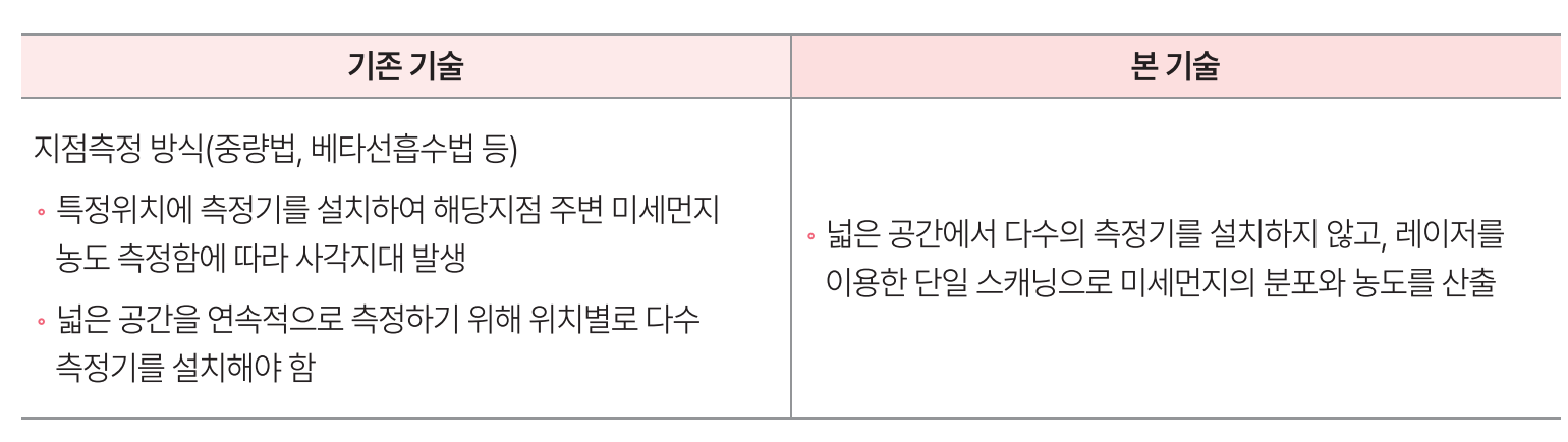
Competitive Advantages of the Technology
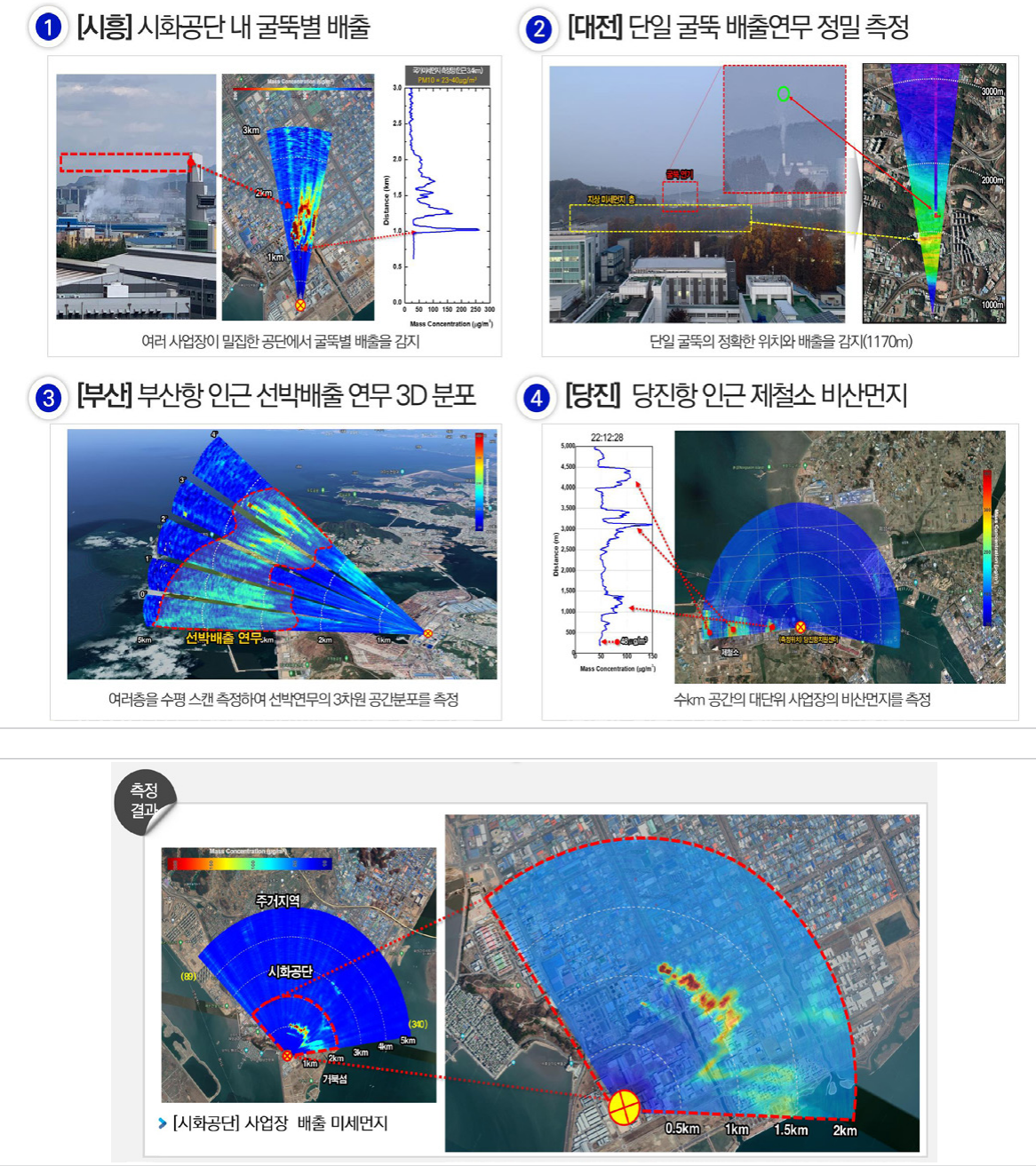
Experimental and Demonstration Data
Production of fine particulate matter emission maps for various areas, including industrial complexes, large-scale facilities, and ports
IP Status
| Patent Title | Application No. | Status |
|---|---|---|
| Apparatus and Method for Determining Substances in the Atmosphere | 10-2022-0091966 | Application |
| A Wildfire Monitoring Device and Method Using LiDAR | 10-2023-0007219 | Application |
| LiDAR-Based Device and Method for Predicting the Spread of Wildfire Smoke | 10-2023-0007218 | Application |
| Apparatus and Method for Protecting Telemetry Devices | 10-2022-0091970 | Application |
Applications
| Application Fields | Applicable Products |
|---|---|
|
|
TRL Stage
- 1
- 2
- 3
- 4
- 5
- 6
- 7
- 8
- 9
TRL Level 7
Reliability Assessment and Client Evaluation: Production of Maps Showing Fine Particulate Matter Emissions in Various Emission Areas